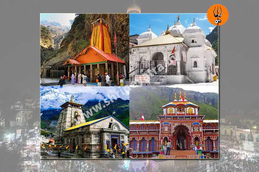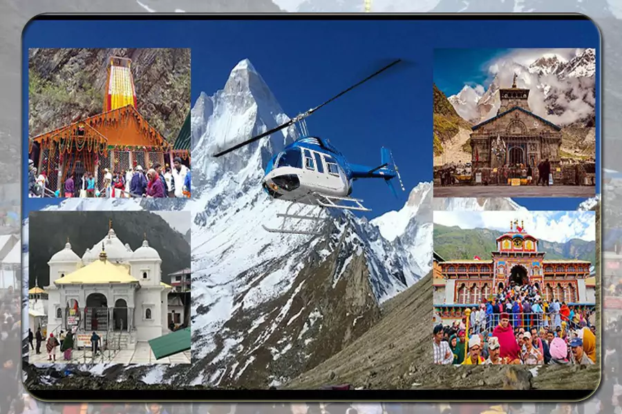
Kedarnath Yatra Route Map: Roads, Trek, and Travel Tips Explained
The Kedarnath Yatra route map is an essential guide for pilgrims planning their journey to the sacred Kedarnath Temple. Located in the Garhwal Himalayas, the temple is one of the twelve Jyotirlingas of Lord Shiva and sits at an altitude of 3,583 meters. The pilgrimage combines mountain road travel with a challenging trek, so understanding the route can make planning easier.
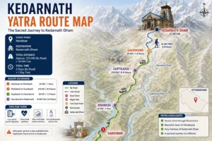
The journey usually continues through the major towns and road routes of Uttarakhand before reaching Gaurikund, the starting point of the Kedarnath trek. From Gaurikund, pilgrims cover around 16–18 km on foot to reach the temple. Depending on their needs, travelers can also consider pony, palki, or helicopter services.
Knowing the Kedarnath Yatra route map helps pilgrims understand the different stages of the journey and plan transportation, overnight stays, rest breaks, and trekking time. A well-organized Kedarnath Yatra package can also simplify these arrangements for families and first-time travelers.
Introduction to Kedarnath Yatra & Route Difficulty
The journey has two main challenges: the mountain roads and the uphill trek. The road route toward Sonprayag and Gaurikund passes through hilly terrain, where travel can become difficult during adverse weather. After reaching Gaurikund, pilgrims begin the uphill trek toward Kedarnath Temple.
The trek can be physically demanding because of its length, continuous climb, and high-altitude conditions. Travelers who are not used to long walks should prepare in advance and maintain a comfortable pace.
During the pilgrimage season, facilities such as rest points, medical assistance, and checkpoints are available along the route. Still, pilgrims should remain prepared for changing weather and avoid rushing during the journey.
Key points to remember:
- The road journey ends at the Gaurikund area.
- The Kedarnath trek covers approximately 16–18 km.
- The route includes continuous uphill sections.
- Pony and palki services are available for pilgrims who need assistance.
- Helicopter services provide an alternative to the full trek.
- Weather conditions can affect road and trekking conditions.
- Good fitness and proper preparation can make the journey easier.
Travel Options to Kedarnath
Knowing the available ways to reach Kedarnath makes it easier to plan your pilgrimage, especially when you are traveling with family or have limited time. The journey combines road travel with the final mountain section toward the temple. Pilgrims can choose road, rail, air, or helicopter travel based on their budget, comfort, and physical ability.
By Road to Kedarnath
Road travel is the most commonly used option for the Kedarnath Yatra. Pilgrims generally begin from Haridwar or Rishikesh and travel through the major towns of the Garhwal region before reaching the trek base.
Main road route:
Haridwar → Rishikesh → Devprayag → Srinagar → Rudraprayag → Guptkashi → Sonprayag → Gaurikund
The journey offers beautiful views of mountain valleys and rivers but also includes winding roads and steep sections. From Sonprayag, pilgrims use local transport to reach Gaurikund, where the trek toward Kedarnath begins.
By Train to Kedarnath
Kedarnath does not have a railway station. Travelers arriving by train need to continue their journey by road from a nearby railway station.
The commonly used railway stations include:
- Haridwar Railway Station
- Rishikesh Railway Station
- Dehradun Railway Station
After reaching one of these stations, pilgrims can hire a taxi, use bus services, or join a tour package for the onward journey to the Kedarnath route. Train travel can be a convenient choice for pilgrims coming from Delhi and other major cities.
By Air to Kedarnath
The nearest major airport is Jolly Grant Airport in Dehradun. After landing, travelers continue by road toward the Kedarnath base route.
Air travel can save considerable time for pilgrims coming from distant cities. However, the remaining road journey still requires proper planning because Kedarnath Temple has no direct road or airport access.
By Helicopter to Kedarnath
Helicopter services provide a faster alternative for pilgrims who want to reduce road travel and avoid the full trek. Services operate from designated helipads in the Kedarnath region, subject to weather and operational conditions.
This option can be particularly useful for senior citizens and travelers who may find the trek physically difficult. Helicopter seats are limited during the busy pilgrimage season, so advance booking is recommended.
Quick comparison:
- Road: Suitable for most pilgrims and offers flexibility.
- Train + Road: A practical option for budget-conscious travelers.
- Air + Road: Saves time for travelers coming from distant cities.
- Helicopter: Faster and more convenient for pilgrims who want to avoid the full trek.
New Kedarnath Trek Route After the 2013 Floods
The 2013 floods brought major changes to the Kedarnath trekking route. After extensive reconstruction, authorities developed an improved trail with stronger infrastructure and better facilities for pilgrims. The present route follows a safer alignment through several key stopping points on the way to the temple.
Current Kedarnath trek route:
Gaurikund → Jungle Chatti → Bheembali → Linchauli → Kedarnath
The updated trail is designed to stay away from vulnerable riverbanks and areas prone to landslides. Reinforced pathways, bridges, drainage arrangements, and designated rest areas help pilgrims navigate the mountain terrain more comfortably.
The trek is approximately 16–18 km one way and can take around 6–9 hours, depending on walking speed, fitness, weather, and breaks. Since the trail involves a continuous climb, pilgrims should maintain a steady pace and allow enough time for rest.
For travelers planning their Kedarnath Yatra, checking current route conditions before starting the trek is important, as weather can affect accessibility.
Facilities Along the Kedarnath Trek
Several facilities are available along the trekking route to support pilgrims during the journey. Their availability can vary by location and season, so travelers should not rely entirely on facilities along the trail.
Medical Facilities
Pilgrims may find medical and emergency support at important points along the route, including:
- First-aid facilities at selected locations
- Medical assistance during the yatra season
- Oxygen support at higher-altitude areas
- Emergency assistance when required
Food & Rest Facilities
The trek has various places where pilgrims can take a break and refresh themselves.
- Tea and food stalls
- Drinking water facilities
- Designated rest areas
- Temporary shelters and accommodation options
Transportation Assistance
Pilgrims who cannot or do not wish to complete the entire trek on foot can consider alternative services, subject to availability and weather conditions.
- Pony and horse services
- Palki (doli) services
- Helicopter services
- Local assistance along the route
These facilities make the Kedarnath trek more manageable for pilgrims with different travel needs. However, proper preparation remains important because the route involves high altitude, changing weather, and prolonged walking.
Route Mapping & Distance Tables
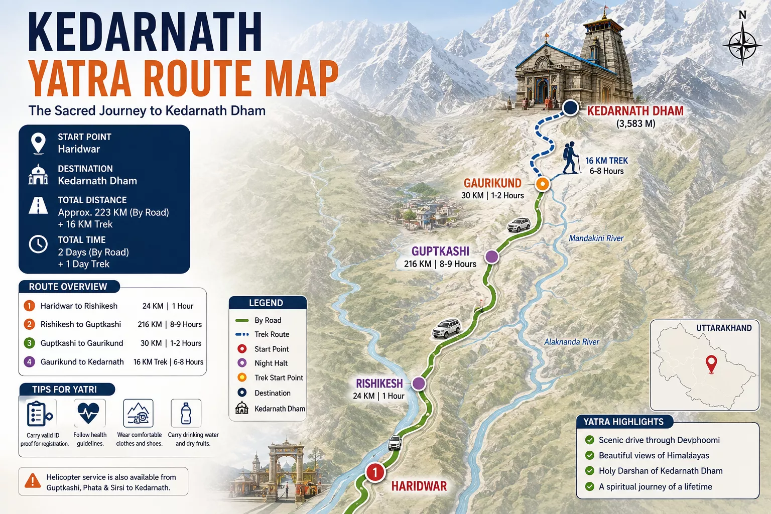
A clear Kedarnath route map makes it easier to understand the different stages of the pilgrimage. From Haridwar, the journey passes through several important towns before reaching Gaurikund, the starting point of the trek. The following route details give a simple overview of the approximate distances.
Haridwar to Kedarnath Route Map
|
|
|
|---|---|
| Route Segment | Approx. Distance |
| Haridwar → Rishikesh | 25 km |
| Rishikesh → Devprayag | 70 km |
| Devprayag → Srinagar | 35 km |
| Srinagar → Rudraprayag | 33 km |
| Rudraprayag → Guptkashi | 45 km |
| Guptkashi → Sonprayag | 30 km |
| Sonprayag → Gaurikund | 5 km |
| Gaurikund → Kedarnath (Trek) | 16–18 km |
Total Distance to Kedarnath
The road journey from Haridwar to Gaurikund covers approximately 220–230 km. From Gaurikund, pilgrims continue on the 16–18 km Kedarnath trek to reach the temple.
Most travelers allow around two days for the journey from Haridwar, depending on their itinerary, road conditions, and rest requirements.
Travel Tips for the Kedarnath Pilgrimage
A little preparation can make the journey more comfortable and help you avoid unnecessary delays. Keep these important points in mind before starting your trip:
- Start your road journey early to avoid traffic on mountain routes.
- Check weather and road conditions before departure.
- Carry warm clothes even when traveling during summer.
- Keep sufficient cash because banking facilities may be limited in remote areas.
- Complete the required Yatra registration before traveling.
- Stay hydrated and take regular breaks during the trek.
- Avoid rushing, especially while walking at higher altitudes.
- Follow instructions from local authorities throughout the journey.
Planning your Kedarnath Yatra route map in advance also helps you estimate travel time and choose suitable overnight stops.
Distance from Major Indian Cities to Kedarnath
Pilgrims traveling from different parts of India can first reach Uttarakhand by train or flight and then continue toward Kedarnath by road. The approximate distances below provide a general idea of the journey.
|
|
|
|---|---|
| City | Approx. Distance to Kedarnath |
| Delhi | 450+ km |
| Mumbai | 1,600+ km |
| Hyderabad | 1,900+ km |
| Chennai | 2,400+ km |
| Ahmedabad | 1,200+ km |
| Jaipur | 700+ km |
These distances can vary depending on the selected route and starting point. Travelers coming from distant cities often combine train or flight travel to Dehradun, Haridwar, or Rishikesh with road travel toward the Kedarnath route.
Final Thoughts
The Kedarnath Yatra route map gives pilgrims a clear picture of the journey from the plains to the high Himalayan shrine. The route combines road travel through important towns such as Rishikesh, Devprayag, Rudraprayag, and Guptkashi with the final trek from Gaurikund to Kedarnath.
Knowing the available travel options, trek route, approximate distances, and facilities along the way makes trip planning much easier. Pilgrims can choose road travel, train and road combinations, air travel, or helicopter services according to their time, budget, and physical comfort.
The present trekking route also provides better infrastructure and support than the earlier trail. Still, the high altitude and changing mountain weather require proper preparation. As explained in this complete guide for Kedarnath Yatra, travelers should plan their registration, transportation, accommodation, and trekking schedule in advance.
Whether you are traveling independently or choosing a tour package, a detailed Kedarnath route map can help you understand each stage of the pilgrimage and prepare for a smoother journey.
Frequently Asked Questions About Kedarnath Yatra Route Map
1. What is the Kedarnath Yatra route from Haridwar or Rishikesh?
The commonly used route passes through Devprayag, Srinagar, Rudraprayag, Guptkashi, Sonprayag, and Gaurikund. From Gaurikund, pilgrims continue toward Kedarnath Temple by trek or available alternative services.
2. How can I reach Kedarnath from Haridwar step by step?
Travel by road from Haridwar toward Guptkashi or Sonprayag. From Sonprayag, continue to Gaurikund using permitted local transport. The final journey to Kedarnath is completed by trekking or other available travel options.
3. What is the new Kedarnath trek route after the 2013 floods?
The present route generally follows Gaurikund → Jungle Chatti → Bheembali → Linchauli → Kedarnath. Reconstruction after the 2013 disaster brought improvements to the trekking infrastructure.
4. What are the different ways to reach Kedarnath?
Pilgrims can travel by road, train plus road, air plus road, or helicopter. Road travel takes you toward the trek base, while helicopter services provide a faster alternative subject to availability and weather conditions.
5. How long is the Kedarnath trek?
The trek from Gaurikund to Kedarnath is approximately 16–18 km one way. The walking time varies according to fitness, pace, weather, and rest breaks.
6. What facilities are available on the Kedarnath trek route?
Pilgrims can find food stalls, drinking water points, rest areas, medical assistance, and other support facilities at different points along the route. Pony and palki services may also be available during the pilgrimage season.
7. How far is Kedarnath from Delhi?
The road distance from Delhi to the Kedarnath route is approximately 450+ km, depending on the exact starting and ending points. After reaching Gaurikund, pilgrims must continue toward the temple by the designated route.
8. Can I reach Kedarnath Temple directly by car?
No. Kedarnath Temple does not have direct road access. Vehicles can travel toward the designated road-head areas, after which pilgrims must use the permitted trekking or other available services to reach the temple.
9. Which Kedarnath route is suitable for first-time travelers?
The commonly used route is Haridwar/Rishikesh → Guptkashi → Sonprayag → Gaurikund → Kedarnath. It is widely used by pilgrims and can be planned through an organized tour or independently.
10. What should I keep in mind while traveling on the Kedarnath route?
Complete the required registration, start the trek early, carry suitable warm and rain-protective clothing, stay hydrated, take regular breaks, and check weather and route updates before traveling.