Most Famous Glaciers in Uttarakhand
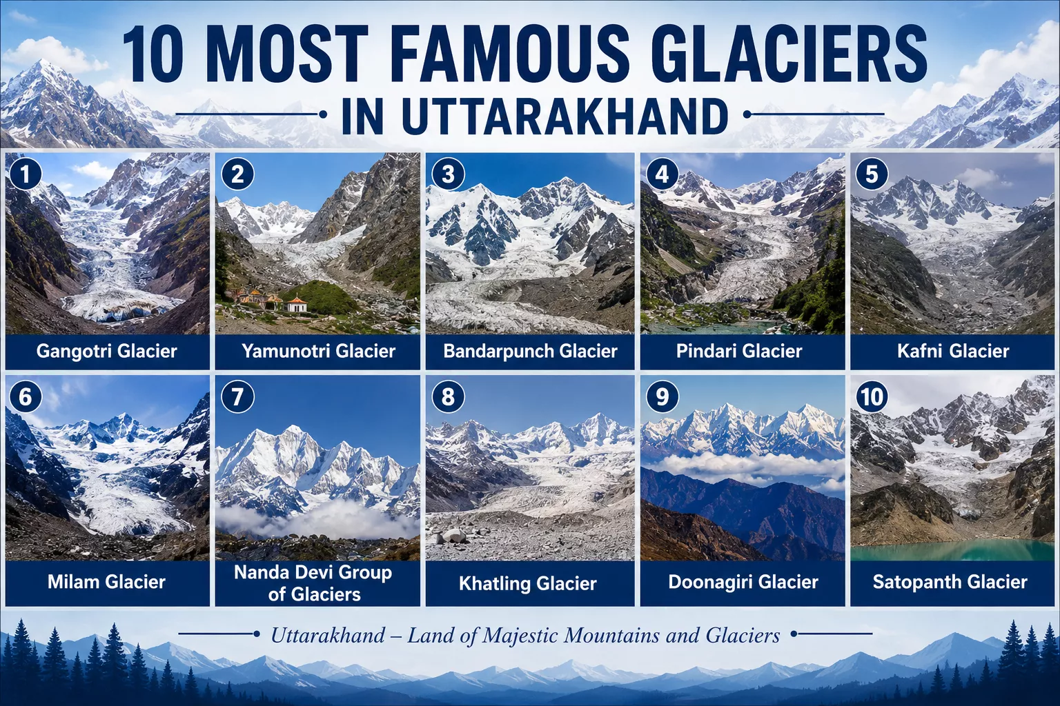
Glaciers cover close to a tenth of the Earth’s land surface and hold more fresh water than any other reservoir on the planet, releasing it slowly as meltwater across temperate, alpine, and polar regions alike. India’s share of this frozen network sits almost entirely in the Himalayas, and a large concentration of it lies within Uttarakhand, a state so identified with its glacial rivers that it’s officially styled Devbhumi, the land of the gods. Uttarakhand is home to an estimated 1,439 glaciers spanning roughly 14,060 square kilometres, and beyond their ecological weight, many are pilgrimage sites in their own right, drawing devotees and trekkers alike. Here are ten of the most significant.
1. Gangotri Glacier
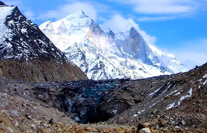
At around 30 km long, Gangotri is the second-largest glacier in India after Siachen, and the primary source of the Bhagirathi River — the headstream that becomes the Ganga once it merges with the Alaknanda at Devprayag. The glacier’s snout, Gaumukh, sits roughly 19 km beyond Gangotri town at an elevation of about 4,023 metres, while the town itself, one of the four Char Dham sites, sits lower at around 3,100 metres. The trek from Gangotri to Gaumukh is a well-worn pilgrim route, and the area doubles as a base camp for mountaineers attempting Shivling and the Bhagirathi peaks.
2. Yamunotri Glacier
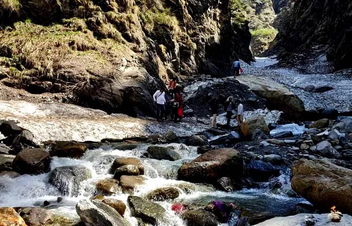
Formally called the Champasar Glacier, this ice mass on the southwestern slopes of the Bandarpoonch massif sits at roughly 4,421 metres and feeds the Yamuna, one of Hinduism’s most revered rivers. Unlike many glaciers on this list, Champasar itself is largely off-limits to trekkers due to its difficult approach; most visitors instead trek toward Saptarishi Kund, a frozen lake fed by the glacier’s meltwater, passing through snow-laden forest and past several smaller lakes en route.
3. Bandarpunch Glacier
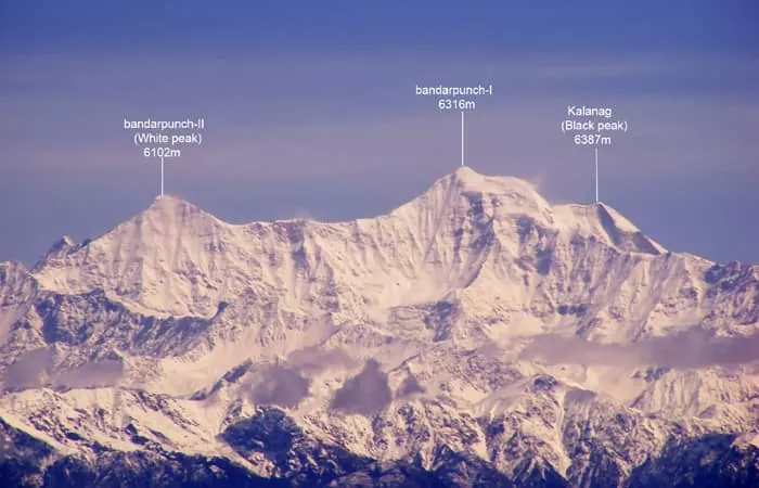
Named for the “monkey’s tail” silhouette of the peaks above it, Bandarpunch sits below a summit that rises to 6,316 metres in the western Garhwal region of Uttarkashi district, and feeds both Ruinsara Tal and the Hanuman Ganga, tributaries that ultimately join the Yamuna. The trek begins at Taluka, reachable by jeep, and passes through forests of walnut, willow, and chestnut before reaching Osla village — the same settlement known for its unusual temple to Duryodhana — after which the trail steepens toward Ruinsara Lake, a natural camping site just below the glacier’s snout.
4. Pindari Glacier
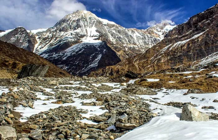
The trek to Pindari runs roughly 90 km round trip from Loharkhet to Zero Point and back, following the Pindar River through oak and rhododendron forest past waterfalls and open views of Nanda Devi, Nanda Kot, Panwali Dwar, and Maiktoli. It’s rated moderate and typically takes six days, making it accessible even to first-time high-altitude trekkers. The route passes through Dhakuri before reaching Khati, the last inhabited village on the trail, after which snow and ice dominate the landscape all the way to Zero Point.
5. Kafni Glacier
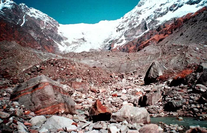
Kafni sits on the left flank of the Pindar Valley at around 3,800 metres in Bageshwar district, framed by Nanda Kot and Nanda Devi, and feeds the Kafni River, which eventually joins the Pindar and then the Ganga system. Reaching it means first following the Pindari trail as far as Dwali, from which point Kafni is a feasible one-day round trip — the payoff being a wide-open view across the main Himalayan range.
6. Milam Glacier
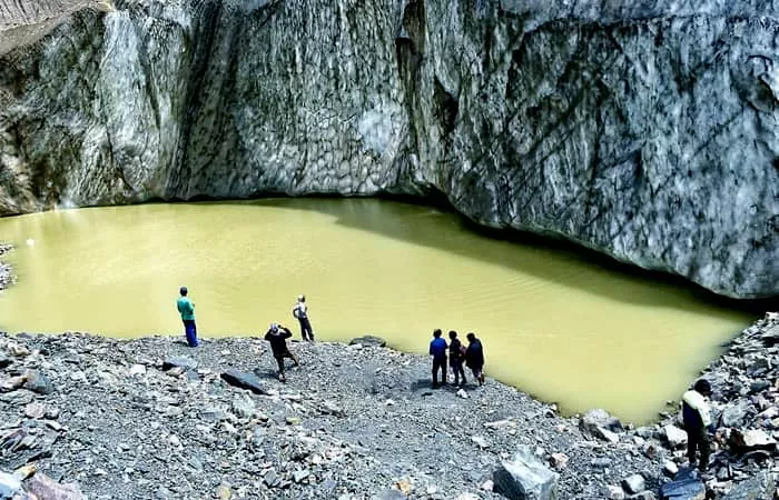
The largest glacier in the Kumaon region by surface area, at roughly 37 square kilometres, Milam sits in Pithoragarh district between the Trishuli and Hardeol peaks and feeds the Gori Ganga, a tributary of the Kali river. The trek from Munsiyari covers about 60 km one way and takes ten to fifteen days round trip, rated moderate despite its length. The route was closed to civilians for over three decades after the 1962 Indo-China war and only reopened in 1994; it remains walkable only between May and October.
7. Nanda Devi Group of Glaciers
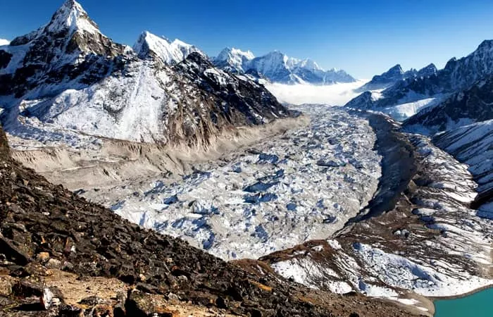
This is a cluster of seven glaciers inside the Nanda Devi Biosphere Reserve, a UNESCO World Heritage Site in Chamoli district built around Nanda Devi, India’s second-highest peak. Nanda Devi North and Nanda Devi South, the two glaciers closest to the summit itself, feed the streams that become the Rishi Ganga, later joining the wider Ganga system. The most common route into the group is the trek to Nanda Devi East Base Camp, which shares its early stages with the Milam trek out of Munsiyari before branching off near Rilkot toward the Panchu Glacier.
8. Khatling Glacier
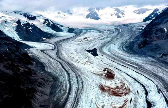
Sitting at around 3,717 metres in Tehri district, roughly 50 km from Gaumukh as the crow flies, Khatling is boxed in by the Jogin group, Sphetic Pristwar, Barte Kauter, Kirti Stambh, and Meru peaks, and is the source of the Bhilangna River, a major tributary of the Bhagirathi. All three approach routes demand prior high-altitude trekking experience; the most common, from the village of Ghuttu, takes around ten days and ends at Gaurikund — the same trailhead used for the Kedarnath temple trek.
9. Doonagiri Glacier
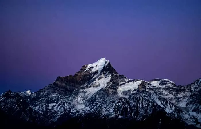
Part of the sprawling Dhauliganga glacier system, which includes more than 500 individual glaciers of varying size, Doonagiri stretches about 5.5 km and tops out near 5,000 metres. Its meltwater feeds a stream that joins the Dhauliganga River, itself a tributary of the Alaknanda. The trek starts at Juma village, 43 km from Joshimath, reaching Doonagiri village in a single day, with the glacier itself reachable — and campable — within a further day’s walk.
10. Satopanth Glacier
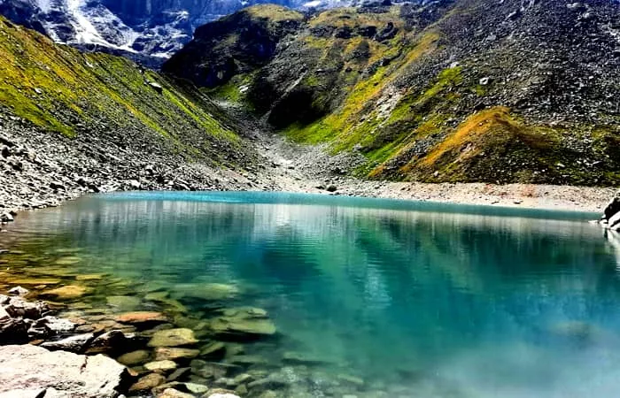
This 13 km glacier on the northwest side of Neelkanth peak, fed by the eastern slopes of the Chaukhamba massif, is the source of the Alaknanda, the river that flows past Badrinath and later merges with the Bhagirathi to form the Ganga. The trek begins at Badrinath, passing through Mana — India’s last village before the Tibetan border — and Vasundhara Falls en route to Chakratirtha, framed by views of Chaukhamba, Neelkanth, Satopanth, and Balakun. Satopanth Tal itself, a triangular glacial lake five kilometres further, is revered as the spot where Brahma, Vishnu, and Shiva are each said to have meditated at one corner. Experienced trekkers sometimes continue beyond the lake to the Swargarohini Glacier base camp via Chandrakunda and Surajkund, following the route mythology assigns to the Pandavas on their final ascent to heaven.
Frequently Asked Questions
Is the Gaumukh trek difficult?
It sits between moderate and difficult. The trail crosses genuinely rough, high-altitude terrain – rocky sections, occasional boulder fields, and thinner air – so you don’t need mountaineering experience, but you do need real stamina and endurance.
What route does the Pindari Glacier trek follow?
Kathgodam → Kharkiya → Khati → Dwali → Phurkia → Zero Point → Pindari Glacier, then back the same way. The trek itself effectively begins from Khati village.
What’s the legend behind Bandarpoonch Parvat?
The name translates to “monkey’s tail.” Local legend holds that after his tail was set alight in Lanka, Hanuman came to this mountain to extinguish the flames – a fire, the story goes, that could be put out here and nowhere else.
How many glaciers does Uttarakhand actually have?
Around 1,439, spread across an estimated 14,060 square kilometres and organised into groups including the Gangotri, Nanda Devi, Kamet, Satopanth, Dhauliganga, and Bandarpoonch clusters.
How do I reach Johar Valley?
On foot only – the trek starts at Munsiyari, which is reachable by road from Delhi via Kathgodam and Almora.
Which is the longest glacier in the Himalayas?
Siachen, at roughly 76 km, in the Karakoram range – the longest glacier in the Himalayan system outside the polar regions, and famously the world’s highest militarised zone.
Is Gangotri really the smallest glacier in India?
No — it’s the opposite. At around 30 km, Gangotri is one of the largest glaciers in the country, second only to Siachen, and by far the largest in Uttarakhand.
Which river originates from the Satopanth Glacier?
The Alaknanda, which flows past Badrinath temple, meets the Saraswati at Mana village, and continues on to join the Bhagirathi at Devprayag to form the Ganga.
What’s the legend of Dronagiri Mountain?
In the Ramayana, when Lakshman lay wounded, Hanuman was sent to fetch the Sanjeevani herb from the Himalayas. Unable to identify the correct plant, he carried back the entire mountain – Dronagiri – so that the right medicine could be found.
Are there other glaciers near Kafni Glacier worth exploring?
Yes – Pindari, Maiktoli, and Milam are all within reach of the same general trekking corridor in the Bageshwar and Pithoragarh region.
[ Click Here to Enquiry for Char Dham Tour Packages ]